
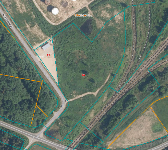
Aukštaičių g. 16, Utena, 28124 Utenos r. sav.
Plot of land
Object information

Savivaldybės

For sale at, For rent

Aukštaičių g. 16, Utena, 28124 Utenos r. sav.

8270/0010:199

4400-4704-7445

2,8170 ha
Object use
Other land uses
Industrial and warehousing site. Commercial properties.
Plot description
No
Grasses, jellies. The elevation difference between the terrain of the site is approximately 5 metres.
Communication lines protection zone - 0,0,378 ha; Road protection zone - 0,0103 ha; Electricity lines protection zone - 0,1706 ha; Land plots with state-owned land reclamation systems and facilities - 2,6644 ha
Communication

Vilnius Airport - 104 km
Kaunas Airport - 121km
Riga Airport - 215 km

The industrial railway line connects Utena with Vilnius, one of the main railway distribution centres in the Baltic States.

Klaipeda Seaport - 325 km
Riga Port - 208 km

The Via Baltica motorway, which connects Eastern Europe with Western Europe and Scandinavia, can be reached from Utena in 1 hour.
Contacts
Strategic Planning and Investment Division of Utena District Municipality Administration
Utenio a. 4, 218 kab., 215 kab.

